Choosing a Trail map
Are you one of those people who likes the excitement of getting lost? If so this article might not be for you. If however, like most walkers, you prefer to know where you are and where you are going you might find this article helpful.
How best to make sure you don’t get lost? The best way is, of course, to use a map. But which map to choose?
‘Paper’ vs digital
Traditionally a map meant a large sheet of tricky-to-fold paper, but times have changed. For a start not all ‘paper’ maps are printed on paper (see below), they aren’t all large sheets, and increasingly some of the most popular maps aren’t printed at all. Smartphone users increasingly use the maps on their phones to navigate. These maps, such as Google maps and Apple maps are great for urban areas, but much less helpful in the countryside. They tend to show very little detail that walkers need, no field boundaries, contour lines or the all important rights of way network. While they are great to help you find your way to the car park, they aren’t so good once you are out on your walk.
There are lots of walking apps though that do let you take a useful digital map with you. The Ordnance Survey (OS) app, for an annual fee, lets you access the entire 1:25,000 and 1:50,000 scale maps for the UK and download the ones you want to take with you. You can also download a free digital copy of any paper OS map you buy. Other apps allow you buy OS maps and store them for offline use. Viewranger is one of the most popular walking apps, it’s free to use but you do need to pay for Ordnance Survey mapping. You can buy just the sections you need to complete a National Trail though, you don’t need to pay for all the full sheets.

The advantages of using digital maps are:
- Your device will show you where you are (with the blue dot) so it is much easier to navigate
- You can carry a lot of maps on one device
- The maps don’t weigh anything or take up space in your pack.
The disadvantages are:
- Not all maps are useful, make sure you have the right maps, don’t rely on Google maps for navigation on a walk
- Your device is likely to be sensitive to getting wet – make sure you have a good waterproof case if you are going to use it to navigate
- Using maps drains battery life, if you are using your device for a long walk carry something to charge your phone, or only look at the map infrequently, or you may find your phone is dead just when you need it most.
- If you use an app that requires you to download maps before you set off make sure you have all the right sheets or you may walk off into empty space
Even if you use digital maps sometimes it’s good to have a map in your pack, one without a battery, and there is lots of choice.
What scale is right? …
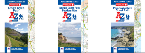
The most popular walking maps are the 1:25,000 scale Ordnance Survey maps. These show lots of detail including field boundaries so you can see which side of a fence you should be on. You can buy this scale map from the Ordnance Survey – the orange Explorer maps. The same mapping is used by A-Z in the official National Trail Adventure Atlases, and by Yellow publications in their Zig Zag maps. Sections of 1:25,000 scale mapping are also included in the Aurum Press official National Trail Guides.
If you are doing a long walk, or a long cycle ride you may want a map that covers a larger area, such as a 1:40,000 scale Harvey Map or a 1:50,000 scale Ordnance Survey map.
Which map works best for National Trails?
The official National Trail maps are produced by A-Z. They use sections of Ordnance Survey 1:25,000 scale mapping bound into booklets. They are compact and usually cover an entire National Trail in one atlas. They are a very cost-effective and easy to use map especially for long distance walks. They are checked and approved by the National Trail Officers so can be relied on to show the most up to date route.

Zig-Zag maps fold out in a zig zag shape. They use 1:25,000 scale OS mapping, but some of them are zoomed in to 1:16,000 making the maps very clear and easy to read. They are laminated to make them waterproof. They tend to cover smaller areas than the A-Z maps, so several are needed to cover a National Trail, and not all Trails are available.

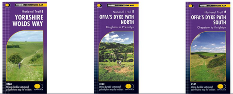
Harvey maps use a different mapping base, one designed to work for walkers and runners. The Trail maps break the trails into sections. They are printed onto polythene that looks like paper, but is waterproof. Trail maps are produced at 1:40,000 scale so most National Trails are on one map.

Ordnance Survey Explorer maps cover a large area, but you would need to buy several to cover a National Trail. It can be tricky to work out which maps you need – the National Trail website maps and guides pages will tell you, and direct you to the OS shop to make it easier. If you are planning on walking in the same area again it might be worth considering buying OS map sheets, but if you are a doing a Trail as a one off it’s an expensive way to buy your mapping, and you may end up with a pack full of maps.
If you fancy something completely different Splashmaps produce fabric maps, either using OS or Harvey maps. You can have a bespoke map made up, or choose from a range of products.

